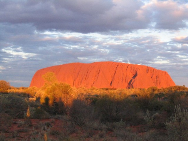
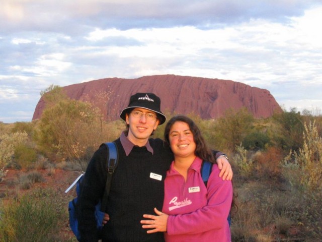
When we arrived into the Red Centre, we first came to this place:
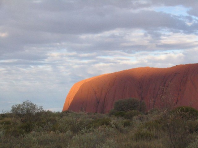
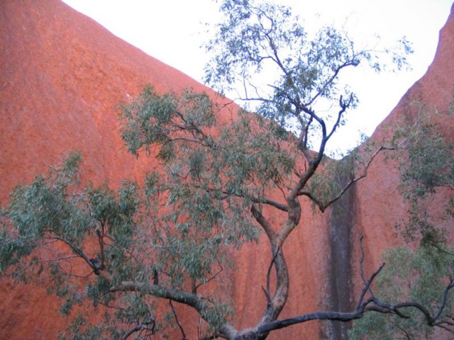
Aborigines call this place "Uluru" and in recent years the Australian government decided to restore it officially to this name. Before that, it was called "Ayer's Rock" after the European explorer who "discovered" it merely 10,000 years after the locals did. The Aborigines of the local tribe (the Anangu folk, pronounced with an accent on the first 'n') consider Uluru and everything around it to be holy ground. Why? Is it because this is the largest above-surface rock in the world? (Like an ice-berg, 90% of this giant is under the surface, but what's above rises roughly 300 meters.) Is it because it's the only thing for miles and miles around, sitting smack in the middle of the world's flattest continent? (It is, in fact, so much smack-in-the-middle that Australians are not flustered to admit that it switched ownership between the state of South Australia and the Northern Territories. Incidentally, there is a half-hour time-zone difference between the two.) Is it because it sometimes seems to glow from within? (As is hopefully apparent in the picture above.) Is it because it tends to change colors abruptly and dramatically? (As is hopefully apparent in the picture below.)

(and in these pictures that were all taken in the same 5-10 minute period.)


The truth is, we may never know why the Aborigines consider this rock to be sacred and why they emphatically oppose climbing on it. The Aborigines keep much of their tradition a secret from European man, and from the little they tell it's impossible to piece more than tiny bits of the puzzle. Nevertheless, I think I can say with confidence why the Anangu tribe has been returning to this place time and again since the dawn of Homo-Sapiens. Here's why:
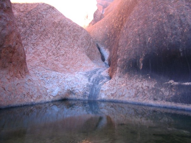
This is the only place in this part of the continent where there is water all year round. This small pond is right under the Uluru. It draws its water from the fact that the Uluru's large table-top is very large, and all water falling on it get funneled into the same place. The pond also gets water from rivers running in the area. If you look right above the water-line, you'll see several lines, showing how the water level changes between seasons and before-and-after occurrences of rain. The top-most of these marks dates back to 1976 when hurricane Stacey obliterated the entire city of Darwin, on the north coast of Australia. Some of the water from that hurricane managed to make their way all through the continent until ending up in this lake.
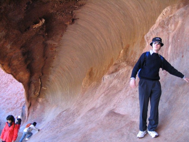
The "white man", too, has found some notable sites surrounding Uluru. These include The Brain
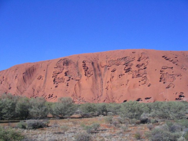
and Darth Vader's Helmet
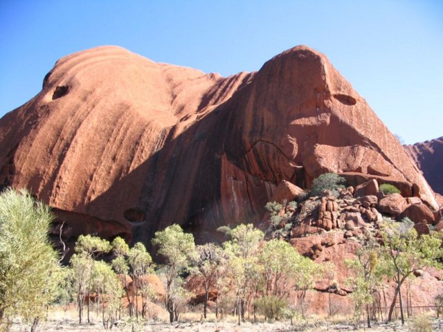
Personally, what caught my eye most were the amazing colors
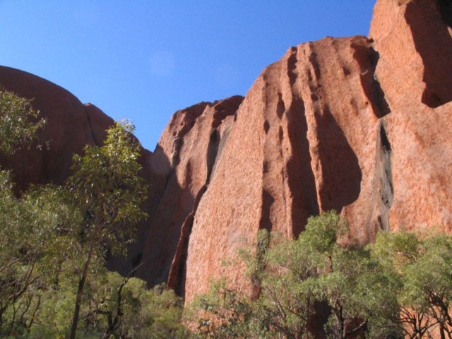
(do you see why it's called "Red Centre"?) and the rock formations
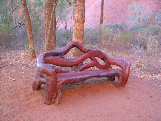
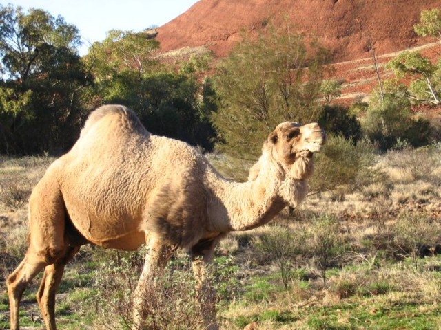
whereas Orit was mostly interested in the architecture
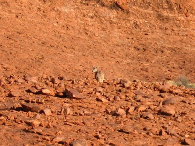
and the wildlife.
These pictures, incidentally, were not taken at Ayer's Rock. They were taken on Mt. Olga.

Like Uluru, the Olgas also suffer from split personalities. The Anangu refer to them as Kata-Tjuta. Together, Uluru and Kata-Tjuta form the major sites in "Kata-Tjuta National Park". Also like the Uluru, the Kata-Tjuta turns into marvelous colors at twilight:
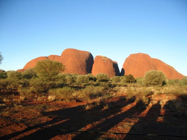
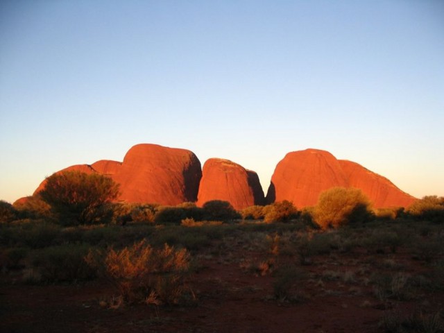
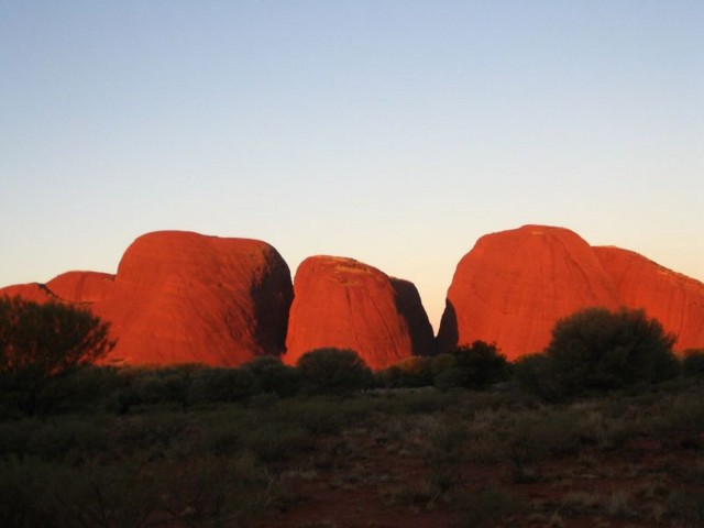
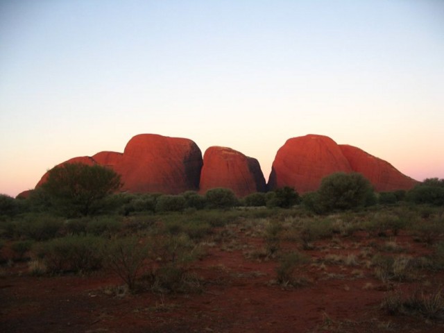
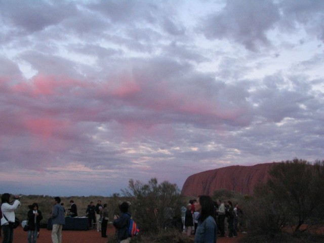
The spectacle we got over the Olgas was, in fact, better than the one over the Uluru, because, as you can see from the pictures, we reached the Olgas on a cloud-free day. However, the bright side of clouds over the Uluru was that we witnessed a spectacular sunset. (Trust me, when your bus driver gets out of the bus and starts taking pictures, you know it's a spectacular sunset.)
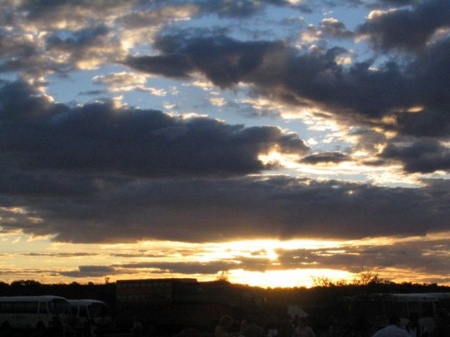
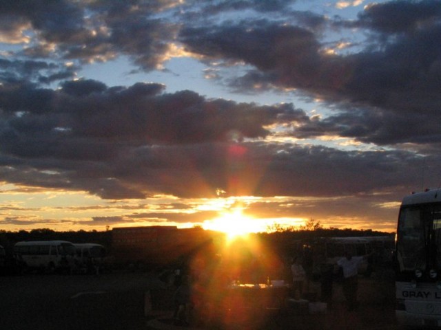
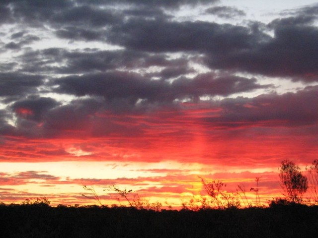
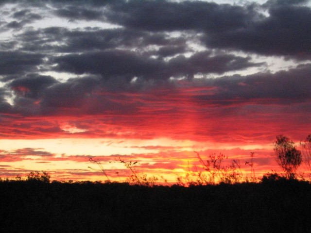
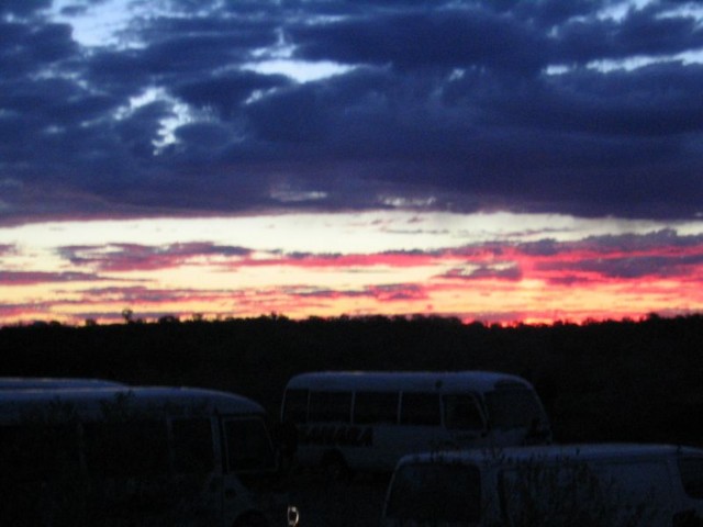
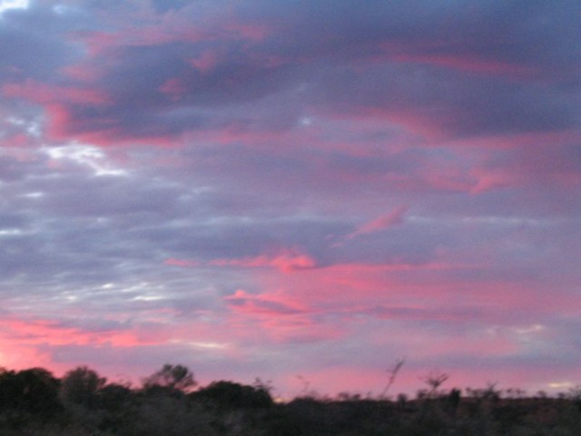
You can't see a sunset anything like that anywhere else in the world. It stems from the large amounts of red dust in the air. Take a look at these images, taken eastwards at the same time: